Mapping the Periplus
The dominance of the map was not as clear in antiquity and in a pre-modern era and the “form of narrative of journeys” was a common way of representing space and place; the Periplus Maris Erythraei is a perfect expression of this relative conceptualization of space. Nonetheless, the Periplus Maris Erythraei has always drawn interest for its geographical information, therefore, multiple maps have been produced through the centuries since the inception of the study of this text.
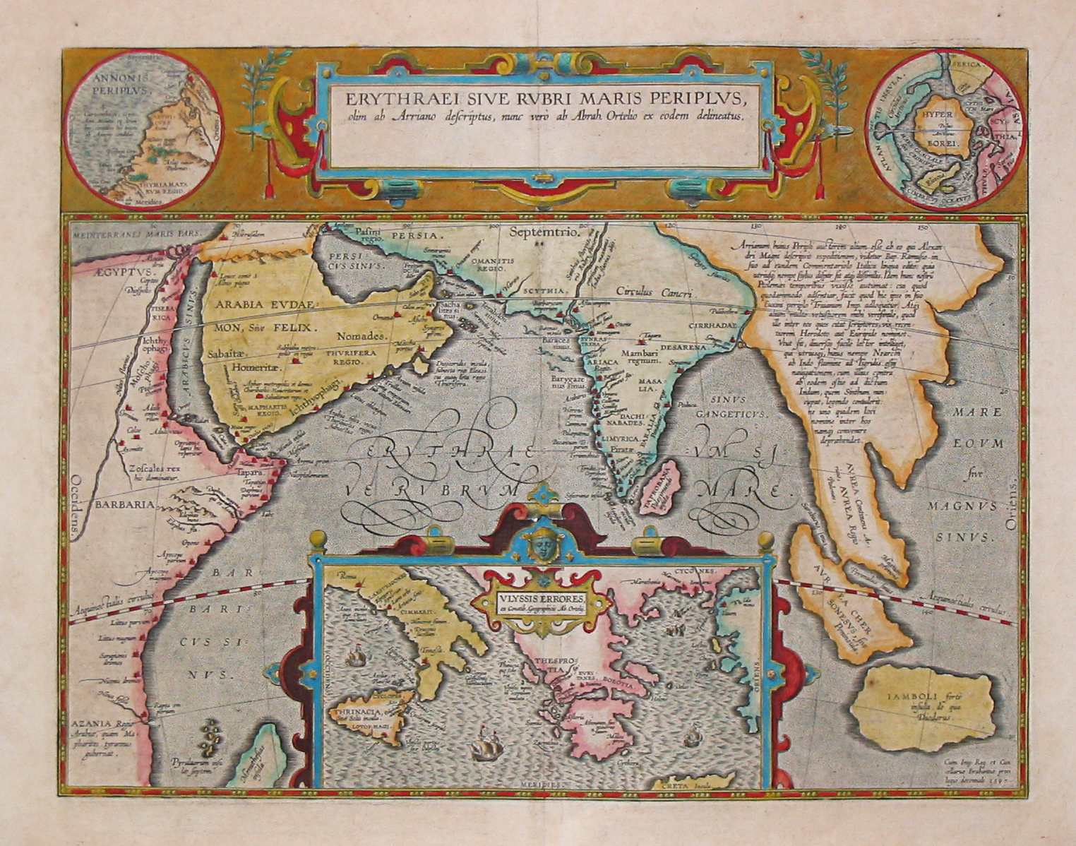
The earlier map we have available is a 1597 map depicting the locations of the Periplus of the Erythraean Sea, depicted here below.
The maps I produced are the following
- An interactive map depecting all sites
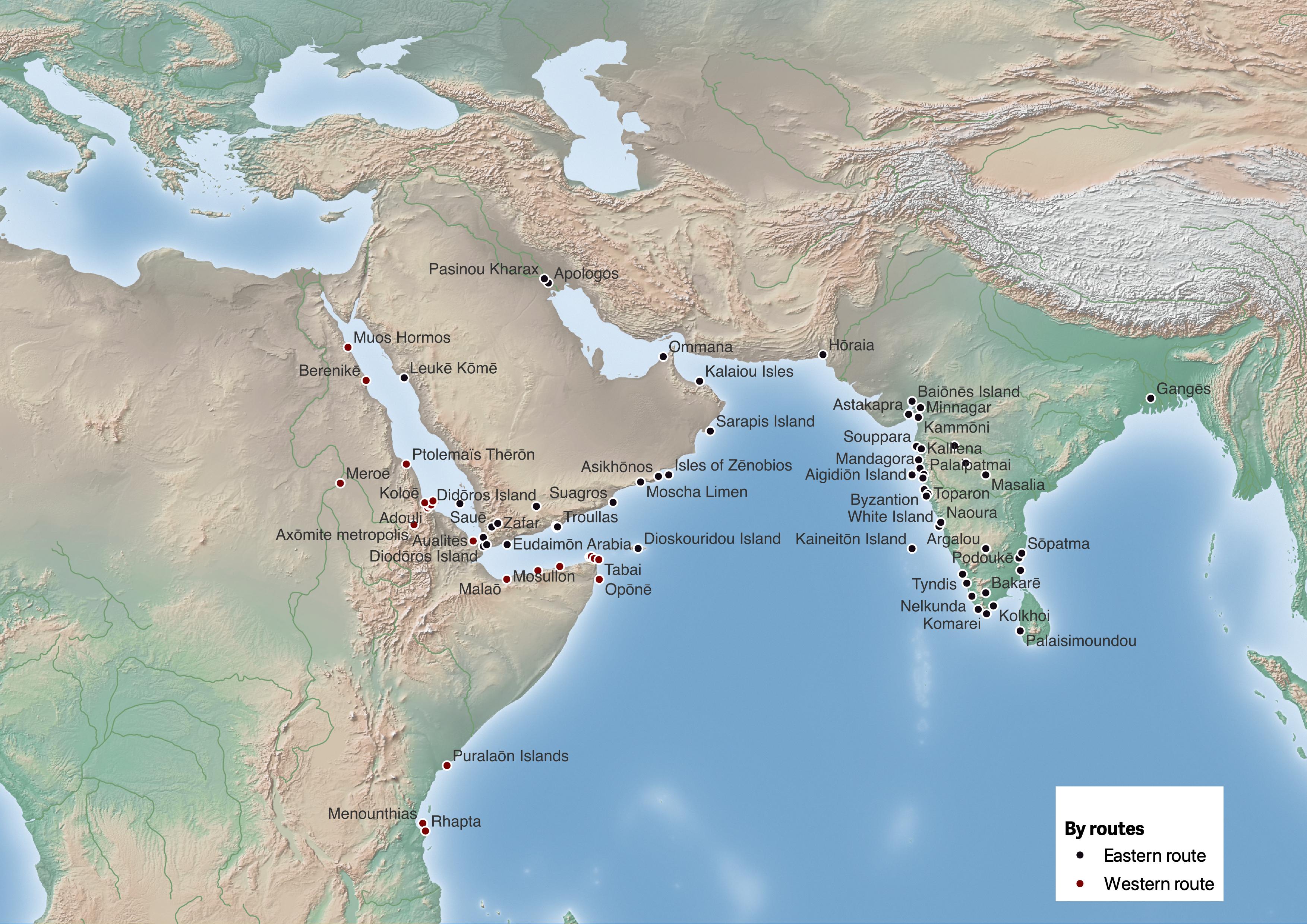
- A map representing all sites clustered by the two different routes: the Western Route, along the Eastern African coast of the Red Sea, which begins with the port of Muos Hormos and ends with the port of Rhapta, and the Eastern Route, from the Arabian Coast to the Indian Ocean, which begins at Leukē Kōmē and ends in the loosely defined port, or country, of Thina
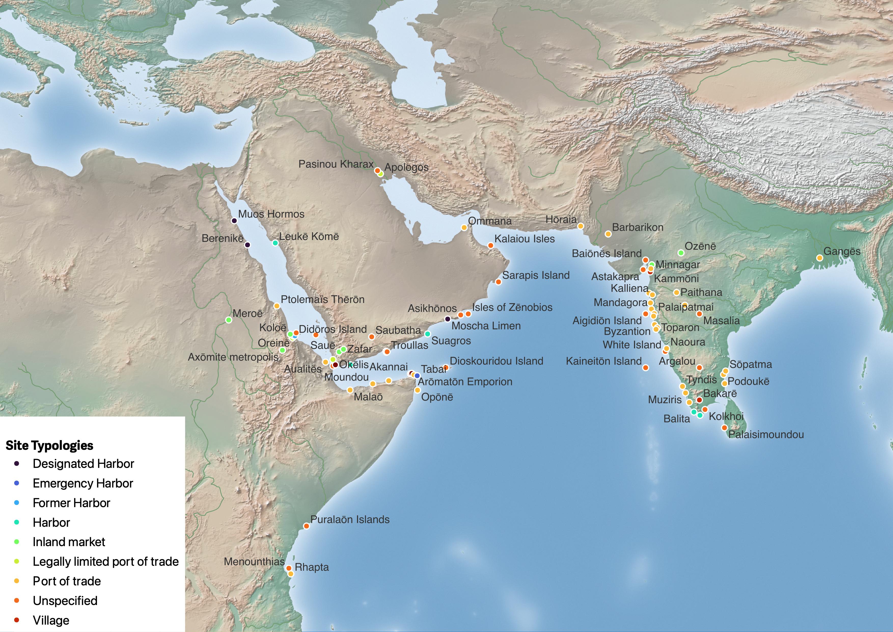
- A map representing all sites divided by place types
- A map representing all sites divided by location certainty
Interactive map of all sites
Click on each site to see information on the site.
Map by route
Map by place types
Map by location certainty
